GPS tracking, training stats, navigation, goals, and community
Track it. Train for it. Navigate it. Share it.
WalkRideGo brings GPS recording, deep activity stats, goals, badges, segments, route discovery, GPX/FIT imports, offline maps, turn-by-turn navigation, and social progress into one app for walking, running, hiking, and cycling.


Explore farther. Train smarter. Move together.
Built for walkers, runners, hikers, cyclists, and groups who want route libraries, GPS tracking, trend charts, goals, badges, segments, offline maps, imports, exports, and shareable progress.
Built for the full outdoor activity workflow
From discovery to tracking to analysis and sharing, WalkRideGo keeps routes, navigation, personal stats, goals, badges, segments, offline maps, imports, exports, and community updates in one place.
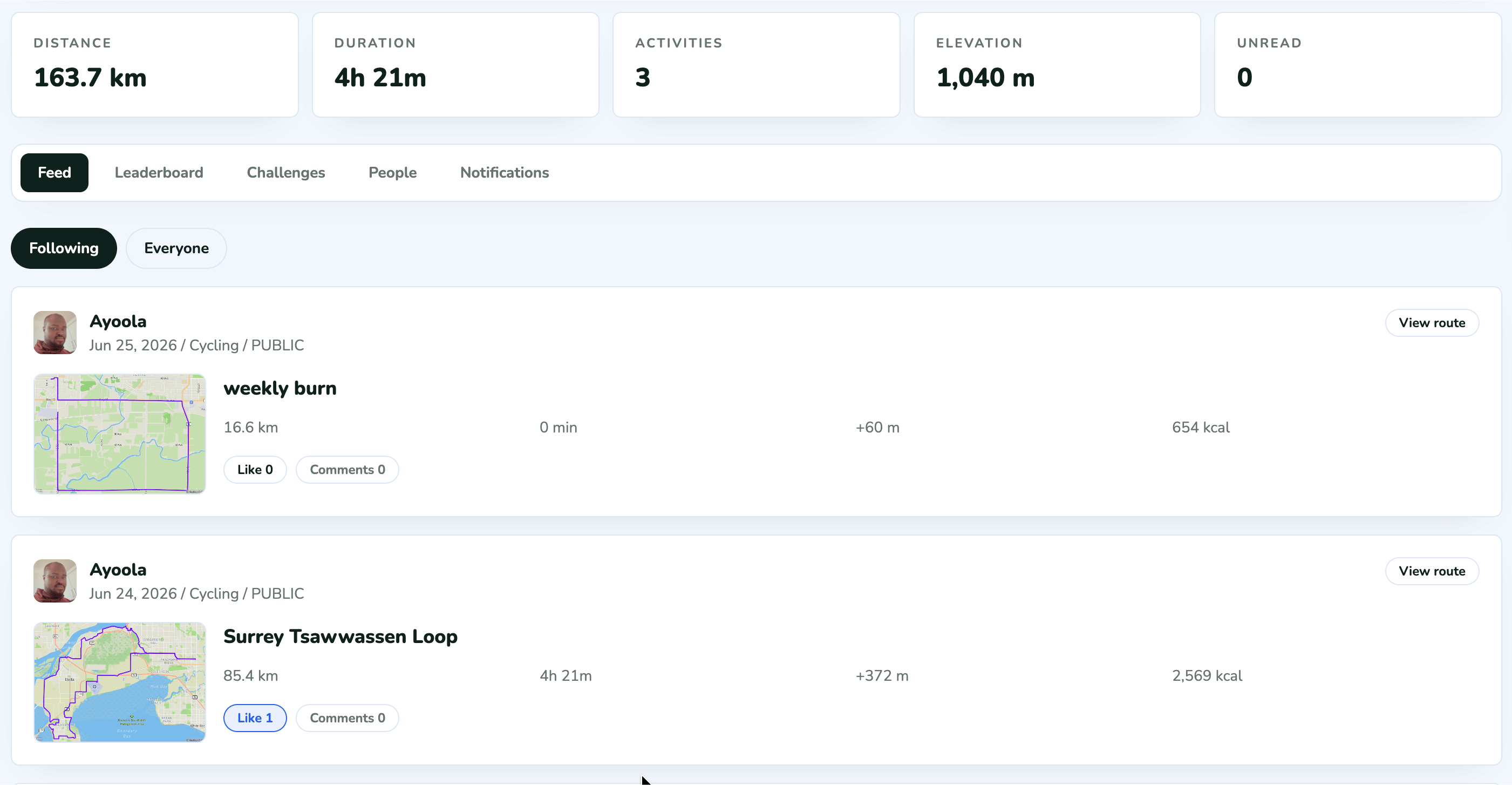
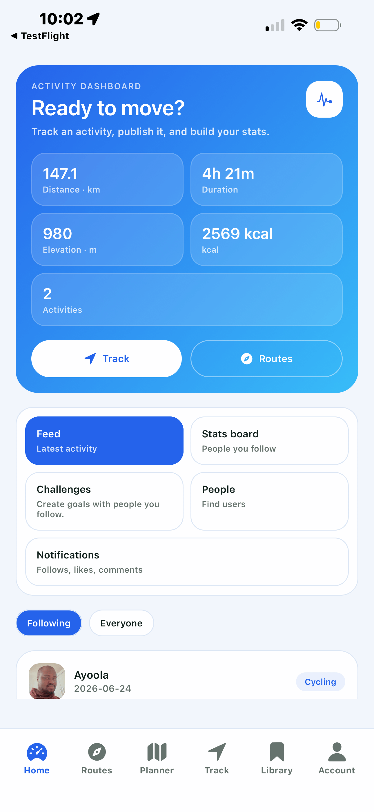
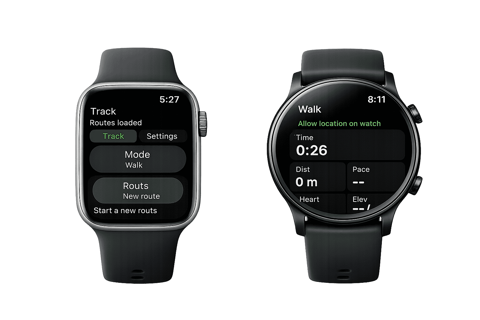
GPS activity tracking
Record walks, runs, hikes, and rides with distance, duration, elevation, calories, route history, and privacy controls.
Stats, goals, and badges
Review weekly, monthly, and yearly trends, activity splits, active days, personal bests, goals, and achievement badges.
Navigation and offline maps
Use full-screen maps, turn-by-turn guidance, direction arrows, saved offline map areas, and easy recentering.
Routes, library, and imports
Pick a start, add stops, choose your destination, import GPX/FIT files, rename routes, and keep your library available when you are offline.
Saved routes and route files
Save routes for later, import GPX/FIT files, export GPX/FIT, or publish route info for others to explore.
POI-aware routing
Route to points of interest and add them as stops with one tap.
Surface and activity modes
Choose walking, running, hiking, cycling, paved, unpaved, or mixed contexts so routes match the way you move.
Training, progress, and community
Record walks, runs, hikes, and rides with GPS, then turn that history into trends, goals, badges, segment efforts, and shareable profiles.
Live activity GPS
See your path, pace context, route line, and return options in real time while you move.
Segments and leaderboards
Create and complete route segments, compare efforts, and keep personal stats separate from community boards.
Stats that build over time
Track weekly, monthly, and yearly trends, activity splits, active days, personal bests, goals, badges, and segment efforts.
Pricing
Start free, then upgrade to Pro for custom routes, unlimited POIs, full tracking, offline map downloads, stats, goals, badges, GPX/FIT import/export, and advanced activity tools. Enjoy a 14-day free trial on Pro.
Free
Pro Monthly
Pro Yearly
Prices shown in USD. Free trial availability is subject to App Store rules and may change.
Get WalkRideGo on iOS and Android
Download WalkRideGo to plan routes, record walks, runs, hikes, and rides, navigate outdoors, and follow your progress.